
For years, I have been fascinated by the landscape around Mount Laki and the eerie story of the eruption of the series of craters to the west and east of Mount Laki in 1783 and 1784. I have summarized the events in a separate page, but concentrated on Iceland, where the eruption had consequences far into Europe. A dry fog had been detected over large parts of the country, which irritated the lungs and eyes.
We had arrived at the foot of Mount Laki after a journey of around 40 kilometers by off-road vehicle. There is actually a ranger station there, but it was no longer manned at the beginning of September. Fortunately, the toilets had been left open! I hadn’t expected them to be designed as water toilets so high up in the highlands.
The entire course of the Laki Crater is now part of the Vatnajökull National Park. It is therefore forbidden to walk off the paths or to fly drones. There used to be a second ascent from the ranger hut at Laki, which is still marked on many maps. However, this is now closed, as are other trails around the craters.
We were almost alone, there was only one other car in the parking lot for hikers a little higher up. So we parked our car there and made our way up the 818-metre-high Laki. It is also an old volcanic cone, but was not involved in the eruption of the fissure.
On 2⁄3 of the partly very steep path, you can hike a little to the north and then have a great view of the western row of craters. Incidentally, a signposted hiking trail leads through the fissure on the slope.
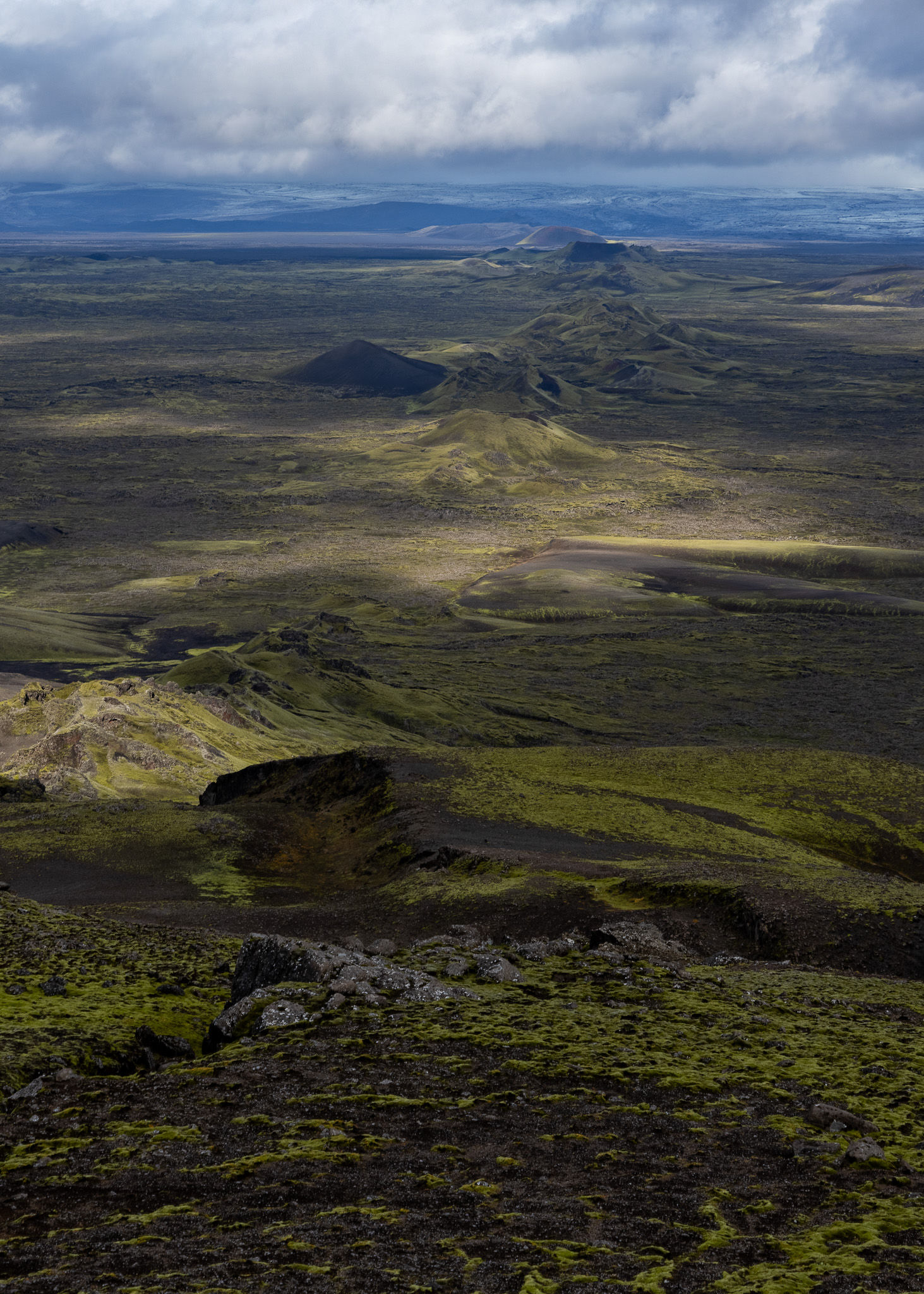
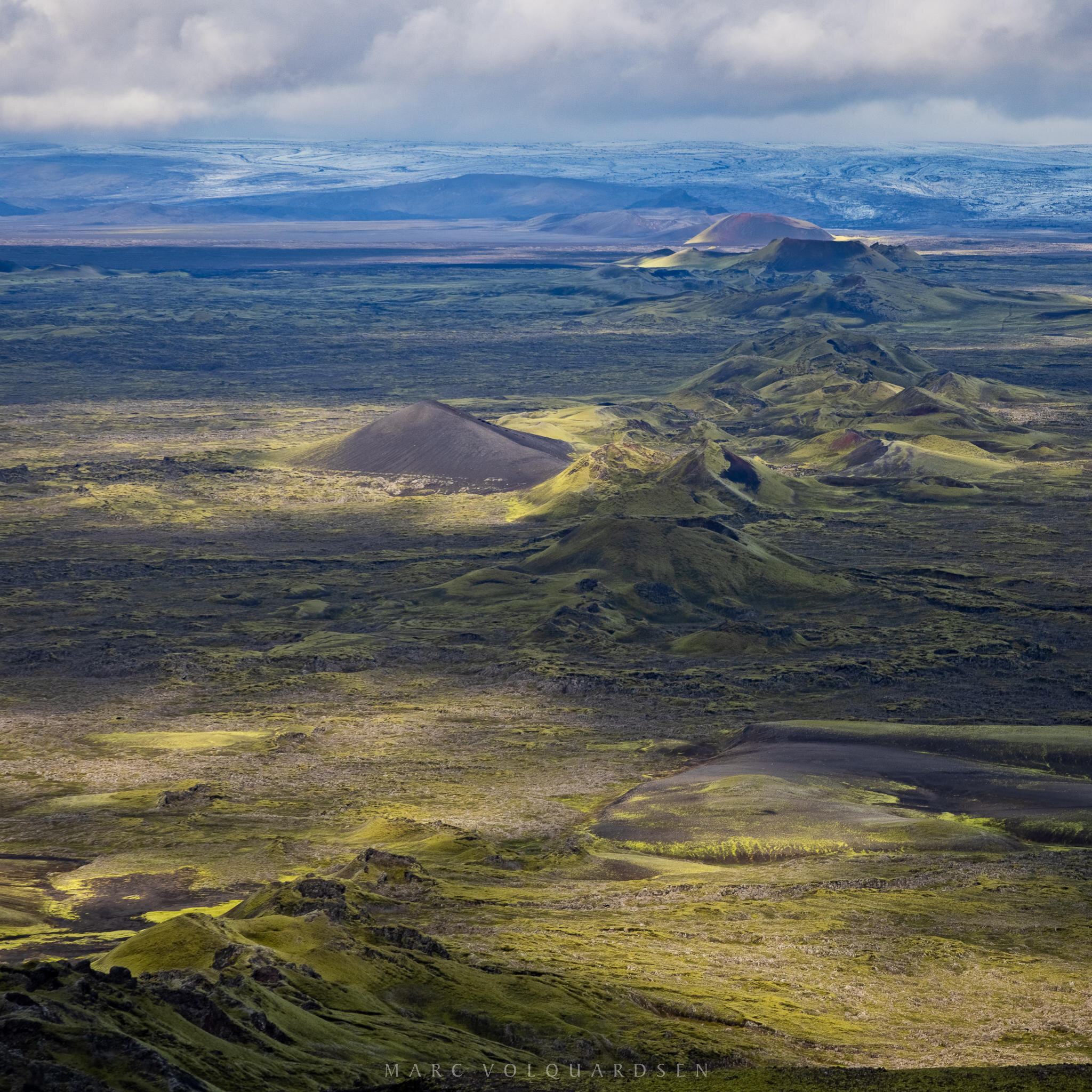
Luckily for me, the sun briefly broke through the otherwise closed cloud cover and gave me a great view of the craters and the lava flow south of the craters:
We had climbed further up to the summit so that we could also see the eastern craters. Here you can clearly see how they reach the edge of the Vatnajökull glacier. The summit was stormy and we didn’t last long up there. Despite my small, wide-spread travel tripod, I had difficulty getting a sharp picture.
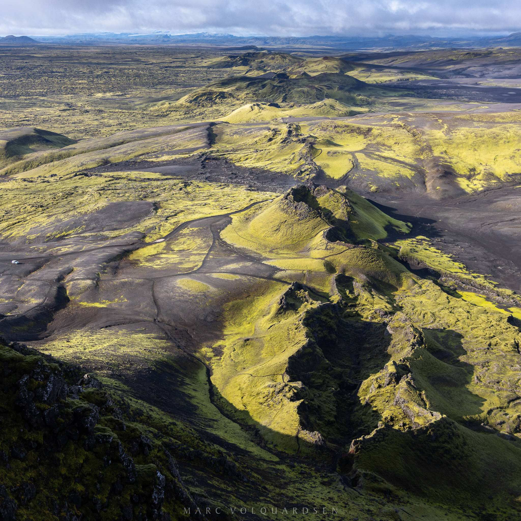
The tuff crater is particularly prominent in this image, as it is also slightly outside the crater row. Tuff craters are probably formed here by phreatomagmatic explosions when rising magma comes into contact with water. Here, the first phase of the eruption had interrupted the course of the Skaftá river, so that a lake had certainly formed further upstream, to the east of Laki.
There is also a tuff crater in the western row of craters.
Leave a Reply